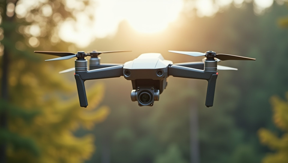
Environmental Monitoring Soars to New Heights
As we continue to grapple with the complexities of climate change, environmental degradation, and resource management, the need for effective monitoring and conservation efforts has never been more pressing. Amidst this backdrop, a revolution is underway in the world of environmental monitoring: drones are taking to the skies.
The Rise of Drone Technology
In recent years, drone technology has undergone a remarkable transformation. Advances in hardware, software, and sensors have made it possible for drones to fly higher, farther, and with greater precision than ever before. This has opened up new possibilities for environmental monitoring, allowing researchers and conservationists to collect data on a scale and scope that was previously unimaginable.
Applications of Drone-Based Environmental Monitoring
Drone-based environmental monitoring is being used in a wide range of applications, including:
- Wildlife tracking and management
- Habitat mapping and surveying
- Water quality monitoring
- Forest health assessment
- Disaster response and recovery
The Benefits of Drone-Based Environmental Monitoring
So why are drones becoming an increasingly popular tool for environmental monitoring? Here are just a few reasons:
- Cost-effectiveness: Drones can be significantly cheaper than traditional monitoring methods, such as helicopters or fixed-wing aircraft.
- Increased efficiency: Drones can cover large areas quickly and efficiently, allowing researchers to collect more data in less time.
- Improved safety: By reducing the need for human observers in remote or hazardous areas, drones can improve safety and reduce risk.
The Future of Environmental Monitoring
As drone technology continues to evolve, we can expect to see even greater innovation and application in environmental monitoring. Already, researchers are exploring the use of drones equipped with advanced sensors, such as hyperspectral cameras and LiDAR systems, to gather detailed information on ecosystems and habitats.
In conclusion, the integration of drones into environmental monitoring is a game-changer. By providing cost-effective, efficient, and safe means of collecting data, drones have the potential to revolutionize our understanding of the natural world and inform more effective conservation efforts. As we look to the future, it's clear that drone-based environmental monitoring will play an increasingly important role in addressing some of the most pressing challenges facing our planet today.
This approach allows researchers to observe and track animal behavior without disturbing their natural habitats. Drones equipped with cameras can capture detailed images and videos, providing valuable insights into population sizes, migration patterns, and habitat usage. This non-invasive method reduces the risk of disrupting or stressing animals, making it an ideal tool for conservation efforts. Additionally, drone-based monitoring enables researchers to collect data more efficiently and effectively than traditional methods, such as on-foot surveys or aircraft observations. By leveraging this technology, scientists can gain a better understanding of wildlife populations and inform evidence-based conservation strategies.
Drones can carry various types of sensors that allow for real-time monitoring of air quality. These sensors can detect pollutants such as particulate matter, ozone, and nitrogen dioxide, providing valuable data on the environmental conditions. By flying over different areas, drones can collect comprehensive information on air pollution levels, which is especially useful in urban or industrial regions where pollution tends to be high. This approach enables authorities to identify sources of pollution and take corrective actions more efficiently. Furthermore, the use of drones reduces the need for stationary monitoring equipment, making it a cost-effective solution.
The use of drones equipped with specialized cameras and sensors enables rapid detection of subtle changes in the environment, such as the onset of wildfires. This technology allows for quick identification of potential fire hazards, enabling swift action to prevent or contain blazes. With their ability to fly low and navigate through dense terrain, drones can access areas that would be difficult or impossible for humans to reach. Their speed and maneuverability make them ideal for surveying large areas in a short amount of time. Early detection by drones can help protect valuable ecosystems and prevent the spread of devastating wildfires.
The use of drones for environmental monitoring decreases the reliance on manned aircraft, which are typically expensive and require a significant amount of personnel to operate. As a result, deploying drones can help reduce operational costs associated with aerial monitoring. Additionally, drones often do not require specialized pilots or extensive training, further decreasing the need for manned aircraft. This shift towards unmanned monitoring allows resources to be allocated more efficiently, enabling larger-scale environmental monitoring efforts. By leveraging drone technology, environmental agencies and organizations can collect data in a more streamlined and cost-effective manner.
Drone-based environmental monitoring utilizes advanced sensors and cameras to gather real-time information on various parameters such as temperature, pH levels, and dissolved oxygen. This technology enables researchers and authorities to quickly identify areas with high water pollution levels. With the ability to fly over vast territories in a short time, drones facilitate rapid data collection, allowing for timely interventions and more effective conservation efforts. By leveraging this capability, environmental monitoring can be conducted on a larger scale than previously possible, providing valuable insights into water quality dynamics. Real-time tracking also enables authorities to monitor the effectiveness of implemented measures to mitigate pollution.
With the growing adoption of drone technology, ensuring their safe coexistence in shared airspace has become a pressing concern. The current lack of effective air traffic management systems specifically designed for multiple drones poses significant risks to both drone operations and general aviation. As the number of drones in use continues to rise, developing robust solutions to manage drone traffic is essential for preventing mid-air collisions and maintaining overall safety standards. This oversight gap can lead to increased congestion, noise pollution, and even accidents if left unaddressed. Implementing effective air traffic control measures will be crucial in unlocking the full potential of environmental monitoring with drones.
The use of drone technology for observation purposes raises concerns about the potential for unwarranted scrutiny. This could lead to individuals being monitored without their knowledge or consent, potentially violating their right to privacy. In some cases, drones equipped with cameras and sensors may be able to capture sensitive information about people's private lives. As a result, there is growing debate about the need for regulations to govern drone use in populated areas. These rules would aim to balance the benefits of drone-based surveillance with individual rights.
The increasing adoption of drones for environmental monitoring has led to concerns about the noise they produce, which can disrupt wildlife habitats and ecosystems. Many areas of interest, such as national parks and protected wildlife reserves, have sensitive environments that require minimal human impact. The noise generated by drones can be loud enough to disturb or even harm certain species, compromising their natural behaviors and interactions. This issue is particularly relevant in areas where the primary goal of environmental monitoring is to preserve biodiversity. As drone usage continues to grow, addressing noise pollution has become a pressing concern for environmental stewards.
The accuracy of measurements taken by sensors attached to drones can be compromised due to various factors such as mechanical stress, electromagnetic interference, and calibration issues. This can lead to inconsistent or even inaccurate readings, undermining the reliability of the data collected. Furthermore, sensor malfunctions or software glitches can also affect the quality of the data obtained from drone-borne instruments. As a result, careful consideration must be given to ensuring that sensor systems are properly calibrated and maintained before deploying them on drones for environmental monitoring purposes. The integrity of the data is crucial in making informed decisions about environmental policies and regulations.
With the rapid growth of drone usage, there is a growing concern regarding their potential to collide with manned aircraft. This issue arises from the similarities in appearance between drones and conventional aircraft, making it difficult for pilots to distinguish between the two. As a result, many organizations are working to implement regulations that would require drones to be equipped with technologies that prevent or mitigate collisions. However, these efforts face significant technical challenges and coordination hurdles. The development of effective solutions is crucial to ensuring safe coexistence in shared airspace.